| Manual Ref* | SUscTH001 Show 4 images | 1164 | ||||||||||||||||||||||
| Title* |
Crocodile |
|||||||||||||||||||||||
| County | Suffolk | District Council | Suffolk Coastal | |||||||||||||||||||||
| Civil Parish or equivalent | Thorpeness | Town/Village* | Thorpeness | |||||||||||||||||||||
| Road | Off the Haven | |||||||||||||||||||||||
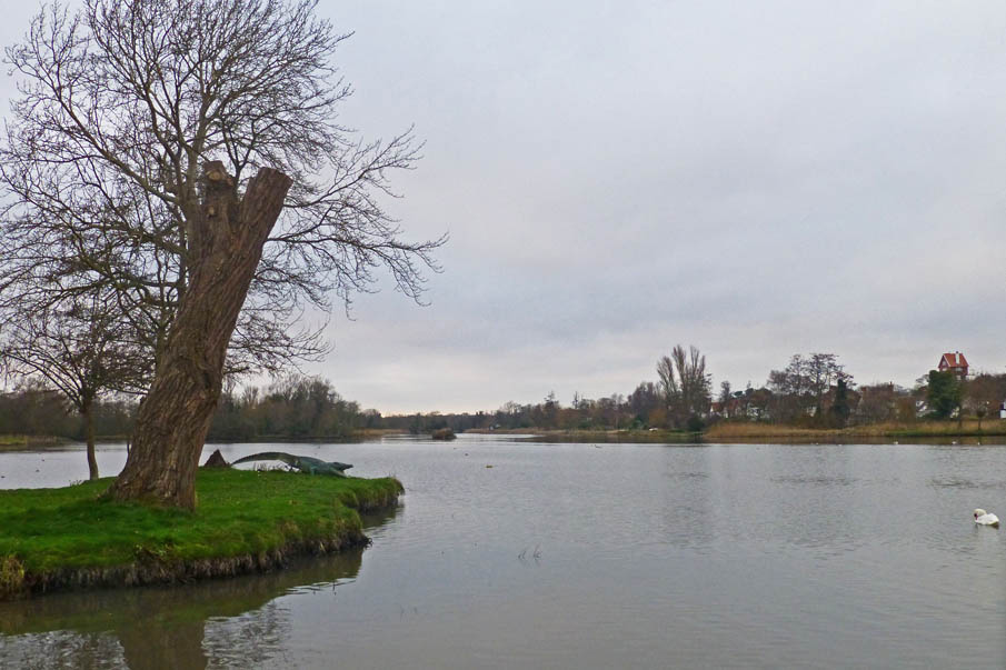
| Precise Location | small island near landing stage | |||||||||||||||||||||||
| OS Grid Ref | TM 470595 | Postcode | IP 16 | |||||||||||||||||||||
| Previous location(s) | Presumably crocodile island (see below) | |||||||||||||||||||||||
| Setting | On island in Meare | Access | Public | |||||||||||||||||||||
|
||||||||||||||||||||||||
|
Commissioned by |
Possibly Glencairn Stuart Ogilvie (see below) | |||||||||||||||||||||||
|
Design & Constrn period |
||||||||||||||||||||||||
|
Date of installing |
Exact date of unveiling |
|||||||||||||||||||||||
|
Category |
|
|||||||||||||||||||||||
|
Object Type |
|
|||||||||||||||||||||||
|
Subject Type |
|
|||||||||||||||||||||||
|
Subject Sub Type |
|
|||||||||||||||||||||||
|
||||||||||||||||||||||||
|
Work is |
|
|||||||||||||||||||||||
|
Owner/Custodian |
||||||||||||||||||||||||
|
Listing status |
|
|||||||||||||||||||||||
|
Surface Condition |
|
|||||||||||||||||||||||
|
Structural Condition |
|
|||||||||||||||||||||||
|
Vandalism |
|
|||||||||||||||||||||||
|
Overall condition |
|
|||||||||||||||||||||||
|
Risk |
|
|||||||||||||||||||||||
| Signatures/Marks | ||||||||||||||||||||||||
| Inscriptions | ||||||||||||||||||||||||
|
Description (physical) |
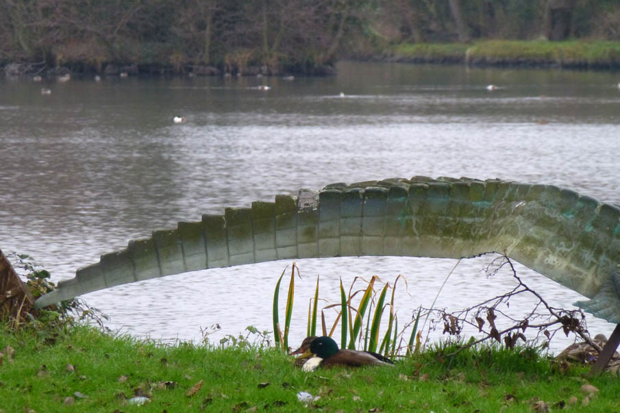
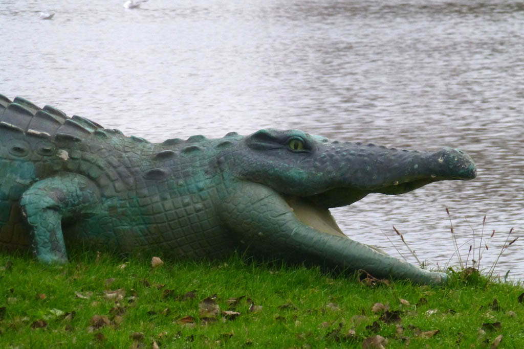
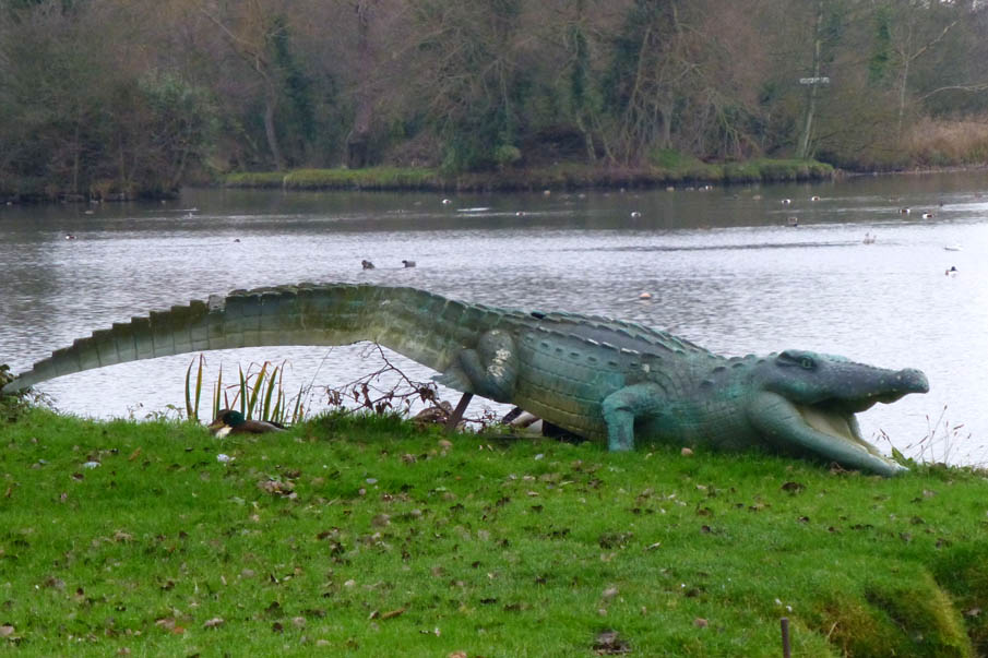
The history of the crocodile with its sword-like tail is not known but an early map of the Meare (published by Philip Dawes from a 1930s guidebook to Thorpeness) shows an imaginative lay-out inspired by Peter Pan and Robinson Crusoe. Islands are named: Peter Pan’s property, Wendy’s house, Crusoe’s island, and to the north Pooks Hill with a crocodile and sign ‘Beware of the crocodile’ snarling across the stream at the dragon on the Dragon’s Den. Early photographs ( a corner of the Meare c1930 p.4 image 9 ) show a, presumably wooden, dragon on top of shelter made out of an upended rowing boat. There are no photographs of the dragon, which is now propped up at the rear and if not the original it may be an early replacement now moved to the small island near the landing stage, | |||||||||||||||||||||||
|
Description (iconographical) |
in 1908 Glencairn Stuart Ogilvie, a wealthy barrister and playwright inherited Thorpeness, part of the Sizewell estate, acquired by his father around 1859. Glencairn Stuart Ogilvie planned a unique holiday village and playground for wealthy families, centred around the inland Meare. The early Elizabethan safe shipping 'Haven' to the west of Thorpe had silted up over the centuries. When it flooded in November 1910, Ogilvie was inspired to create the 64 acre Meare, a key element in his plan for a fantasy holiday village for the upper middle classes, initially family and friends, between the Meare and the sea, themed, as we have seen, to encourage children were encouraged to boat and play. A picturesque Boathouse with a clock tower was built, rowing boats made available for hire, and teas served by the landing stage. In August 1912 the first Regatta took place on the Meare, and continues as an annual tradition in the village. During the day boat races and other competitions take place in and on the water, which is lit at night by Chinese lanterns on boats, and a finale of fireworks ends the festivities as dark falls. The competitors rented the large mock Jacobean and Tudor style houses attractively designed by William Gilmour Wilson and Frederick Forbes Glennie and carefully laid out in natural settings of gorse, heather and heathland. Although the style was mock Tudor, the architects nodded to modernism in their exclusion of sculptural decoration. The large houses were situated along Lakeside, overlooking the Meare, and smaller 'bungalows' erected nearby and in other parts of the village, or adapted from cottages and the Old Barn. | |||||||||||||||||||||||
|
Photographs |
Date taken:
12/1/2013
Date logged: |
Photographed by: |
||||||||||||||||||||||
|
On Site Inspection |
Date: 12/1/2013 |
Inspected by: |
||||||||||||||||||||||
|
Sources and References |
http://aldringham.onesuffolk.net/parish-past-and-present/thorpeness-a-short-centenary-history/ and After 100 years a 100 photos (photos supplied by Peter Drew) ttp://2.bp.blogspot.com/- ttp://seasidesuffolk.blogspot.co.uk/2012/05/map-of-thorpeness-meare.html | |||||||||||||||||||||||
|
Database |
Date entered: 14/1/2013 |
Data inputter: |
||||||||||||||||||||||